Thursday, May 29, 2014

Seongsan Ilchulbong


After picking up our rental car and dropping our luggage at our friends place, we headed to very east of Jeju island to Seongsan Ilchulbong (일출봉) or Sunrise Peak. This mountain rose from an underwater volcanic eruption volcano about 5000 years ago. The top is 180m high, and it has a bowl-shaped crater of 600m in diameter.

Seongsan Ilchulbong as seen from Hangdo-ro

There is plenty of parking space at the entrance. The way up is easy and takes about 25 minutes of stairs. We went up at about 6.30PM to enjoy the sunset (~7.30PM) instead of the sunrise. Main reason was that next day it would be rainy and the day after we would do Hallasan, so we would not have time to enjoy this beautiful volcano anymore with clear weather. 

Seongsan Ilchulbong

Sunset over Jeju as seen from the top

After enjoying one of the best sunset views in my life, we went down again. When arriving at our car we looked up one last time and were surprised the moon seemed sleeping on Ilchulbong. Then we headed to eat some barbecued black pork and horse, which you can only eat on Jeju island.

Moon sleeping on the Sunrise peak


Monday, May 6, 2013

Hiking Inwangsan in Spring

Inwangsan (인왕산) is a rocky hill in the central part of Seoul, which together with Namsan and Bugaksan surrounds Gyeongbokgung palace. This hill is open 24h a day (but is closed on Mondays). You will find many guard points on the mountain, the only thing the guards wanted from me is not to take any specific pictures of the Blue House (but I think I would need a way more expensive lens to do any harm).


How to get there
This hiking area is directly accessible via subway. I went there a couple of times during this stay in Korea, from Gyeongbokgung station (Line3) and via the Dongnimmun station (Line3, exit2). I personally found Dongnimmum station the better option of the two, as it allows you to pass Ingwansa temple (인왕사), for which you can find signs if you walk straight from the subway exit.

The way up is relatively easy and short, and goes along an old castle wall. It is only 338m high, but because of his granite peak (and no trees in the way), it offers great views on central Seoul.

Spring scenery
I love the mish mash of houses and streets in Seoul

Panoramic view
 From the top, I went down the other way, from which I could take a bus back to Gyeongbokgung.

Way down via the other side

After I really enjoyed the panoramic view during the day-time, I decided to go up at night as well. The view is just mesmerizing, as you can see on my picture below. The guards at the start of the trail were very friendly and asked my information and how long I intended to stay on the mountain, just in case I would have a little accident on the stairs.

Night panorama, the dark rectangular area on the left if Gyeongbokgung Palace


Tuesday, April 16, 2013

Hiking in Dobongsan Mountain

Dobongsan (도봉산) is a mountain in the more northern part of the Bukhaksan national park. The highest point is Jaunbong (자운봉) which peaks at 739.5m.

How to get there
This hiking area is directly accessible via subway: Dobongsan station (line 1). When you exit the station, just follow the street with all the hiking shops. It is about 15 minutes walking to the Dobong information center.


My hike
After leaving the station, make sure to grab some freshly baked Korean (sweet) pancakes and kimbab (tasty rice roll in seaweed) for your hike. For this hike, I chose the easiest way up to Jaunbong, which starts at the Dobong information center and then goes via the Dobong shelter and Madangbawi rock to the top. At the information center there was a friendly ranger which started talking to me and was making sure I had enough water and food with me (which I always do).


On the way to the top, there is a small temple complex (Cheonsuksa), which offers some nice views on the granite peaks laying behind.

Jaunbong rising up from behind the Cheonsuksa temple
Iron Buddha's lined up at Cheonsuksa temple


Fish to ring the bell


The way up is relatively easy, it gets a bit more steep after you pass the Madangbawi rock.

Rocky steps from Madangbawi rock to Jaunbong
 
To climb the actual peak, it gets pretty steep, but with there are cables and metal grips to help you.With dry weather and decent shoes it is doable, I would not go up if it is rainy as the granite tends to get really slippy.

Scrambling to the top
View from Jaunbong
To avoid seeing the same things twice, I decided to go back down via Uiam rock. This was a good decision, as it involves walking on a ridge (Dobongjuneung), which is always a nice thing to do, and also some pretty good views on the different peaks of Dobongsan.


View on Jaunbong on the way to Uiam rock

Me on the Dobongjuneung Ridge

Uiam Rock
When arriving back at the information center, a guy walked enthusiastically towards me. It turned out to be the ranger who helped me earlier that day. I did not recognize him as he was not in his uniform, he just finished his shift and was going home. Great to feel how happy he was that foreigners also come hiking on his  mountain.


My actual hiking route (which I did counter-clockwise)

Saturday, October 6, 2012

Gwanaksan Mountain in (early) autumn


At 629 meters, Gwanaksan (관악산) is smaller than it's northern counterpart, Bukhansan, but nevertheless, because of it's rocky peaks, some cliffs and many rugged trails, it is a little hiking paradise in the southern side of Seoul. On the mountain lie numerous Buddhist temples, shrines and hermitages, making it a nice refuge for people escaping city life.

How to get there
Gwanaksan is easily accessible via public transportation (Official Site of Tourism). I took the subway to the Seoul National University station (line 2), Exit3. From there I took a bus (no. 5515) towards the university entrance. You can't really miss it as you just need to follow the other people wearing hiking clothes. Alternatively you can start from Gwacheon station (line 4), but that is where I planned to end my hike.

My hike
In the very beginning, after passing the university campus, the trail passes through Lake Park, which is a small park with an artificial pond, an island and the mandatory wooden bridges. I guess this is a good place for the student couples to have their first romantic dates.

The trail itself is not too steep in the beginning and takes you next to some small streams of water (I guess in  the days after rainfall, the streams will carry much more water). The terrain is a bit rugged from time to time, so I definitely recommend to wear some good hiking shoes, as there are certainly some places where you could easily sprain your ankle. Later on it gets more and more steep, but like in most other parks in Korea, here and there are some stairs installed (or ropes to hold on too).

                    
                           Trail near beginning
Some steeper parts close to weather station

Besides temples, near the top, you will see some radio towers around, luckily not disturbing the view too much. Centerpiece is an (almost) spherical weather station.


Weather station near the top.

What most people are coming for (including me) is actually the inspiring sight on the Yeonjudae Hermitage, which is placed carefully on the edge of a cliff. The hermitage was built in 677 in the Silla Period by a Buddhist priest called Uisang (to which the hermitage was originally named). It changed its name later to Yeonjudae after founding of the Joseon dynasty, by the people that missed the perished Kingdom of Goryeo.


Yeonjudae Hermitage

Yeonjudae Hermitage as seen from the weather station

View inside

180 degree panorama from the area

After a short rest, enjoying the different view from the top and re-energizing myself with some food, I headed back down, but now keeping left on the track. This would lead me towards Gwacheon station. 


Early autumn scenery

I really had a great day today on Gwanaksan and I guess it is only becoming to be more beautiful in the  next weeks, with more autumn colors. Unfortunately, I will not be around in Seoul then, but well... I have something else to look forward to: Seoraksan national park. 


Thursday, October 4, 2012

2012 Gyeonggi Ansan Airshow

The Gyeonggi Ansan Airshow is the largest aviation event in South Korea. It is organized for the 4th time in 2012 and it is held from October 3rd to October 7th. The number of spectators has grown from 300.000 in 2009 to 430.000 in 2011).  

My girlfriend and I went to see the Gyeonggi Ansan Airshow on Thursday afternoon (October 4th). This day, there were not too many people. A Canadian guy who also went the day before (which still fell in the national holiday season) said it was really crowded before.

The airshow event provides various programs like airshows (aerobatics and demonstrations), aircraft exhibition, aviation education and experience zones. 

Airshows
The Thursday afternoon program deviated slightly from the advertised program (so no A-10 Thunderbolt II) and consisted of following shows:
  • Solo: Laszlo Ferencz
  • Solo: Zoltan Veres
  • Demonstration of aerial firefighting aircraft
  • Aerobatics: Team Zoltan Veres
  • Aerobatics: Black Eagles (South Korea)
  • Drift car racing
  • Aerobatics: ULM
  • Solo: Larry Beamish
  • Demonstration of aerial firefighting helicopters

Zoltan Veres doing some sideways flying right above the runway

Aerobatics Team Zoltan Veres

The headline of the event was the Black Eagles aerobatic team, which is the flight display team of the South Korean Air Force. Recently (July 2012) they were awarded with best displays at the Waddington International Airshow (U.K.) and at the Royal International Air Tattoo (U.K.). The current aircraft used are  T-50 Golden Eagle, which is a Korean made multirole fighter plane. 

The maneuvers the team pulled off were really amazing and sophisticated in all aspects:

  • The G-forces the planes and pilots experience are extreme: in worst case maneuver (max turn and loop) the forces go up to 8G (which is also the limit of the plane);
  • The high speed and close proximity between the planes during some maneuvers;
  • The speed the team reassembled the formation after a maneuver;
  • The power of the planes. During a 7 ship maneuver, the 8th plane was out of sight, but suddenly it did a low fly-over coming from behind the audience. The sound was thrilling; 

In my favorite maneuver (don't know the name), two of the pilots brought their planes in a near stall at very low altitude, while two others where bypassing them.

Black Eagles: big arrow (8 ships)

Black Eagles: diamond formation (8 ships)

Black Eagles: heart and cupid arrow (3 ships)

Black Eagles

Black Eagles: victory break (7 ships)


Aerial firefighting helicopter demonstration
Aerial firefighting demonstration


Aircraft Exhibition
The almighty Apache (Ted movie quote):

"Now if there's one thing you can be sure of, it's that nothing is more powerful than a young boy's wish. Except an Apache helicopter. An Apache helicopter has machine guns AND missiles. It is an unbelievably impressive complement of weaponry, an absolute death machine." 
The American pilots accompanying the aircraft were quite friendly and gave some explanations about the equipment like the different kind of flares used etc.

Boeing Apache
Another famous Boeing made helicopter is the CH-47 Chinook which is a tandem rotor heavy lift helicopter, mainly used for transporting troops, artillery and battlefield supplies.

Chinook crew enjoying the sun

Chinook 
Ever wanted to look inside a Chinook?
Besides aircraft, a series of Korean tanks were exhibited. One of them being the Samsung made K-9 Thunder, which is the main battle tank of the South Korean army. It has a firing range of 40.6km and can co-ordinate to deliver a simultaneous arrival of three rounds to target. Top driving speed is 67km/h, not bad for a 44 ton monster.

K-9 Thunder Main battle tank South Korea


The airshow really made a great day out, certainly considering the minimal entry price (5000 SKW, which is only around EUR 3.5). Next time, I just need to make sure I bring better camera objectives and my camera tripod  in order to make better action shots. 

Saturday, September 1, 2012

Huangshan - Sea of Clouds


A sportive looking guide, Tony, welcomed us at the Tunxi airport, quite worried about our unsportive looks. We comforted him, saying we had the sportive stuff packed in our suitcases and we would not drag our complete luggage up to the mountain. Tony advised us to go to experience a spectacle in the local theater, later in the evening. The driver dropped us at the Huangshan International Hotel. Kurt and I took a walk and explored the little city and had some very local food and beers in one of the tiniest restaurants around. After dinner we had to hurry as Tony made a little mistake and the show started a bit earlier than anticipated.

We could hardly follow our guide walking to the theater so we got a bit worried he would keep the same temp going up the mountain as well. The show turned out to be an amazing spectacle with light effects, changing decors, water falls, dancers, dangerous acrobatics and also a dramatic storyline: men having to leave their beloved wifes for hard labor, only meeting again when they became old.  Satisfied, we headed back to the hotel, packed our gear for the next day and hit our beds early. Tomorrow would be a hard day: conquer around 900m altitude difference and then walk around in the Beihai Scenic Area. Good for about 6h of walking in total.


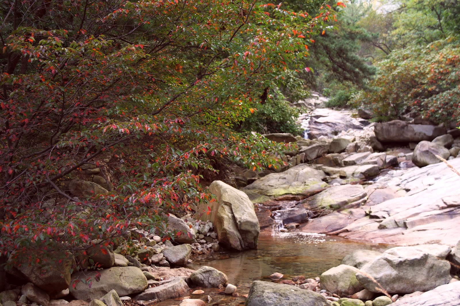
It took a twisting 1-h drive to Yungu Temple, our starting point. Surprisingly, our sportive looking fellow wasn't that sportive at all, cause he would take the cable car up and meet us at the top. The trail was a neverending snake of stairs crawling up the mountain. While just carrying water/food/clothes for three days was heavy enough for us, workers were carying impossible loads up and down the mountain.

 
Workers bringing down the laundry from the hotels

  The walk up was a bit disappointing, but also fun meeting other people finding their breath again. At the end of the trail, we met our guide again. We visited the planned scenic spots in the area, but they were just too foggy to enjoy (no photo's of this included). We relaxed a bit on the room in the Shilin hotel. Suddenly we saw the clouds opening up. We regained full of energy and went back a second time to all the spots we went before. 

Scenery as seen from the Begin-to-Believe-Peak
Now we could only see the true beauty of this place. And we must admit: we also 'began to believe'. Exhausted after climbing enthusiastically up and down different trails on this mountain, we returned to the hotel. Next challenge: be first in line to enjoy the sunrise. Alarm 4.30AM!

Chinese Early Birds
Belgian Earlier Birds
Sunrise seen from Begin-To-Believe-Peak
Monkey Watching The Sea (Find it)
What a sunrise that was... we headed back for a good breakfast and then we planned a long hike: complete the West Sea Grand Canyon, which starts from the Cloud-Dispelling-Pavillion, goes all the way down, back up again, here and there over a dizzying trail, cross over the Fairy-Walking Bridge, over the second highest point of the area: Bright Summit (1880m), ending up back at the beginning.  


Trail above a bottomless abyss
Fairy-Walking Bridge


The canyon trail was worth our every drop of sweat, although our guide didn't seem to share the same opinion. His energy visibly drained out of his body with every step, while we seemed rather tireless, which I rather grant to our excitment about this place than to our physical condition. 

Coming out of the canyon, we continued over the Turtle Peak. Our guide gave up on climbing Lotus Peak (1864m), the highest point of this mountain. This peak, is surrounded by a group of lower peaks, as such, Chinese people think it looks like a lotus flower in full bloom. The way up involved steep stairs (again), so on the top, our legs started to get a bit sore.


Lotus Peak as seen from Turtle Peak


The mandatory posing at the top

The way down from Lotus Peak to the Jade Screen Pavillion, where our hotel was, had some spectacular views and narrow paths. We were completely exhausted when we arrived in Yupinglou hotel, enjoyed a dinner and sunset over the West Sea


View from Lotus Peak to Jade Screen Pavillion and our hotel
 
Unfortunately the Celestial Capital Peak was closed for restauration, so the only thing left to do on the last day was to hike down and visit the Tunxi Ancient Street, for some visiting some old medicine, tea, silk and stone shops.


Tunxi Ancient Street
 
 A writer once said:
 "To enjoy the magnificence of a mountain, you have to look upwards in most cases. To enjoy Huangshan, however, you've got to look downward".
We felt very lucky to enjoy the magnificence of this mountain under perfect weather conditions, but also sad we had to leave this absolute highlight behind us.